FRIDAY, DECEMBER 4, 2015 - PALATKA: I had paddled a few miles on the St. Johns River before, at the end of two Wekiva River trips. My impression of the St. Johns was that it was big, busy and not that interesting. So when this Paddle Florida trip was announced, I wasn’t really interested. Taking a second look some months later, I saw the Bartram History Trail connection that I had either missed or overlooked. I am interested in history, especially Florida history, and this trip seemed to offer a window into Florida’s past that I was largely unaware of. So, I, along with my paddling buddy Alan Lovgren, signed up.
That’s how I found myself on the road north for the three and a half hour drive to Palatka in early December. All I knew about Palatka came from the words of a song by the bluegrass group, Patchwork (“You can tell by the smell when you reach Palatka”). Apparently there is a paper mill there and paper mills generally smell bad. But my friend Andrea Conover tells me she is moving there and that those stories aren't true, at least not any more.
I was concerned about December temperatures so far north in Florida, so I prepared for nighttime temperatures in the forties, day times in the seventies. In fact, temperatures were warmer than that, but with the overcast, rain and wind we encountered, we needed the warmer clothing.
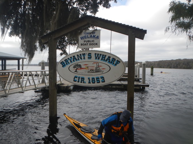
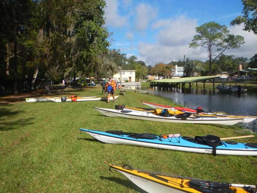
I was surprised to find that Palatka is a large city, at least by the standard set by Sebastian and Vero Beach where I live. Stopping at a roadside Subway shop, I bought a small sub, some cookies and a bottle of milk and headed for our rendezvous spot. It was a little before eleven when I got there. I was among the first to arrive. I registered and headed for a nearby parking lot to drop my boat for the shuttle to Salt Springs State Park, some sixty-five miles up river. My car and trailer were to remain in the parking lot until our return by water five days later.
I secured my car, locking the trailer with a cable through its wheels, then headed for a gazebo on the river to have my lunch. I had time to walk through Riverside Park. It is quite lovely, probably even more so when the wind isn’t blowing as hard as it was. Soon Alan showed up and before long we were all on a bus, headed for Salt Springs State Park, with a convoy of trucks pulling kayak laden trailers following in our wake.
Salt Springs State Park, like so many of Florida’s state parks, has great facilities. On arrival, we headed for the kayak launch area near the head of the spring to help unload boats. Since my back surgery I don’t do as much of this as I used to, but I did help unload mine, Alan’s and one or two others.
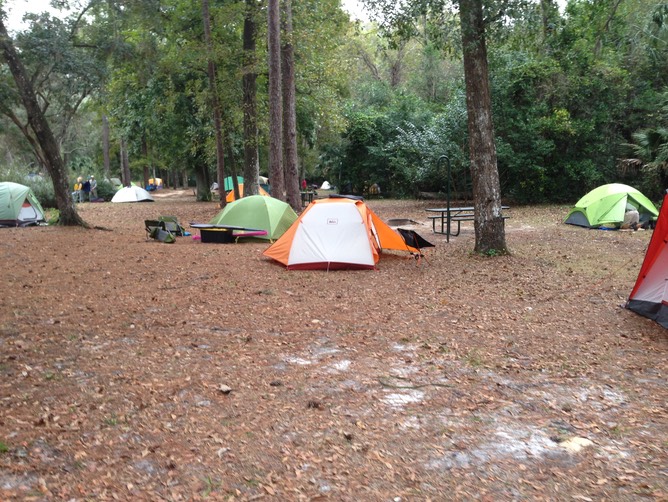
Our camping area was open and spacious. However, it was quite a hike from our tents to the kayak launch, and even further from our tents to the dinner pavilion. Dinner was at 6:30, after dark at this time of year. We followed the crowd to find our way there. Dinner came and went, followed by a somewhat lengthy presentation by Sam Carr and Dean Campbell, two key figures in the development of the Bartram History Trail. About half way through the presentation, Alan, dressed in shorts and a tee shirt, was shivering and I was getting pretty cold too. Alan said he was heading back to camp for warmer clothes, and left. Twenty minutes later he was back in the same clothing he’d been in before. He’d gotten lost in the dark and couldn’t find his way! So he sat down again, still shivering till the presentation was over, when we could follow the crowd back to camp.
SATURDAY, DECEMBER 5, 2015 - ON THE BIG LAKE: The next morning dawned gray and cloudy, threatening rain. But it wasn’t cold. The temperature at 6:15 was sixty-nine degrees. The wind was howling, but it was high up in the trees, not a problem at ground level. I was up at six, packing all my gear while I remained inside my tent. Then as dawn broke I emptied the tent of the gear bags and neatly packed it for transport to our next destination. The next step in this routine is to take the gear bags to the truck and load them.
On these trips, people have all kinds of gear arrangements. In theory we are allowed two duffels weighing a combined forty pounds. In practice people pack in bins, dry bags, duffels and more, with a lot of loose items like chairs, sleeping pads, and coolers, with no regard for weight. Some even bring collapsable carts to get their gear to their tents. It gets kind of ridiculous. My gear is packed in two bags; a large wheeled gear bag with a smaller clothing bag strapped on top. It’s a nice neat compact arrangement that fits nicely inside my tent where it stays clean and dry.
Just before breakfast I took my paddling gear and tent to my boat and stowed it there. I pack the tent in my boat for several reasons. The first is that my boat paddles better with a little weight in it. Secondly, should my tent be wet, and it is often at least damp, I don’t want to pack it in my gear bag. Third, should I become lost or injured and need to spend the night somewhere, I have a shelter with me. Finally, when I get to the next campsite, I won’t to have to hunt for my gear bag in order to get my tent, especially if it is raining or threatening to rain. The gear bags can stay dry in the truck until I have my tent set up. This is the routine I follow on these trip almost everyday.
Our trip today would take us about four miles down the Salt Springs run to Lake George. Lake George is a big lake, a very big lake; six by eleven miles, and shallow, with an average depth of eight feet. At breakfast we were told that no one would be going out on Lake George that day because twenty-five mile an hour winds were predicted out of the northeast, blowing right in our faces. Paddlers were to stop at Lake George and then paddle back up the spring run to camp, where they would be shuttled to the next campsite. A few of us asked permission to evaluate conditions on the lake when we got there and be allowed to paddle through the lake to our day’s destination, if we thought we could handle them. Permission was given and as a result, eight paddlers, including Alan and me, would paddle through the lake to Renegades on the River, our campsite for that night.
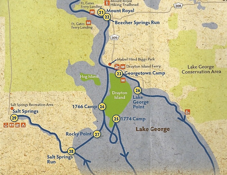
Our Route Day 2: Salt Springs (29) to Lake George (28), to Rocky Point (27) to Drayton Island (near 24), to Renegades on the River (near 22) Map from Putnam County Bertram Trail Brochure.
The paddle down the spring run was quiet and peaceful. The run ran approximately west to east, perpendicular to the wind. Trees on the north side of the run protected us from the northeast wind’s blast. We spotted several birds and a pair of curious river otters along the way. When we reached It’s junction with Lake George, I was in shock. The lake was huge. I hadn't expected it. Because of its size, the wind had an unimpeded fetch of many miles. It was blowing as predicted, directly out of the northeast, the direction of our paddle, at about fifteen to eighteen miles per hour.
The name of Lake Welaka (Lake George) is taken from “Welaka” (meaning “chain of lakes”), the name for the St. Johns River in the language of the Timucua, who inhabited the region prior to European settlement. The first European to visit the lake was Pedro Menéndez de Avilés, who as the Spanish governor of Florida, explored the St. Johns River in the spring of 1596.[1]
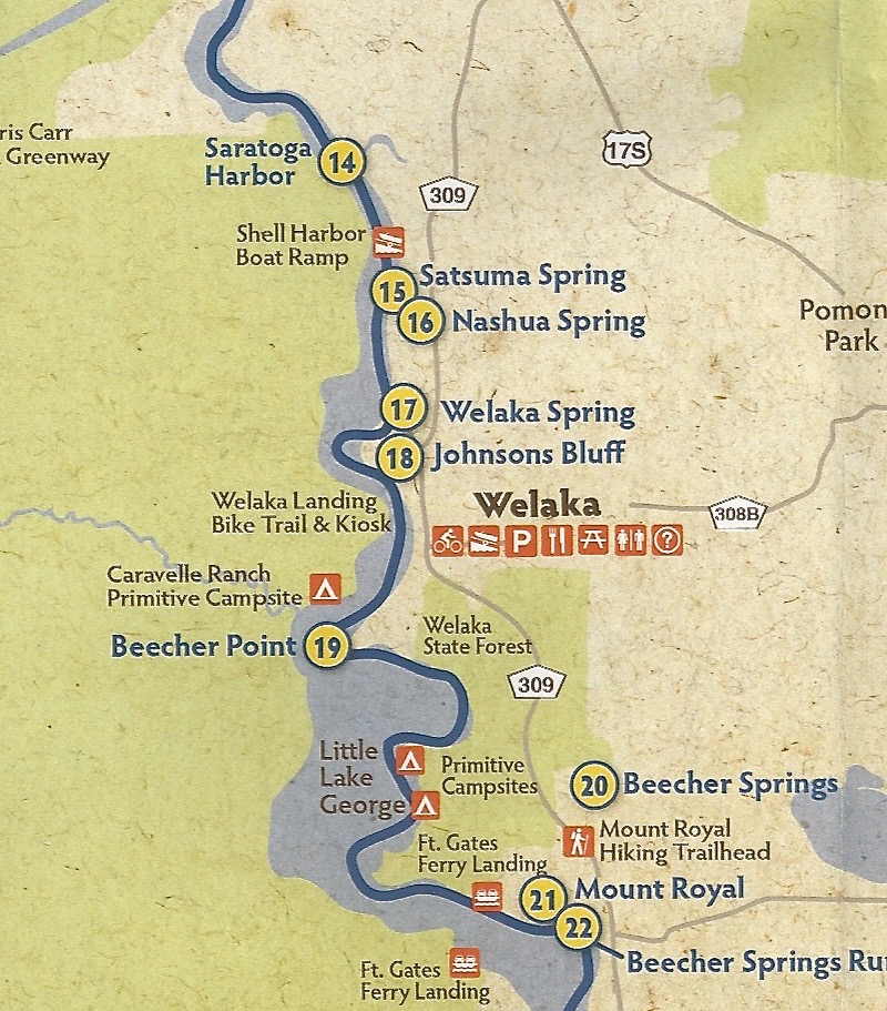
Later, the Florida territory was sold to Britain. The royal botanist in America to King George III, John Bartram, explored the St. Johns River in 1765. It was John Bartram who gave the lake the name Lake George, in honor of his king.[1]
"The lake also hosts a wide variety of wildlife ranging from migratory water birds and alligators to a number of normally marine animals. Local springs in Lake George (and throughout the St Johns River) impart enough salt to the system to make the habitat suitable to resident and migratory marine species like Atlantic stingray, various species of mullet, striped bass and blue crabs. There is a large enough blue crab population to support a local fishery, making it one of the only fresh water blue crab fisheries in the world.
Source: Wikipedia https://en.wikipedia.org/wiki/Lake_George_%28Florida%29
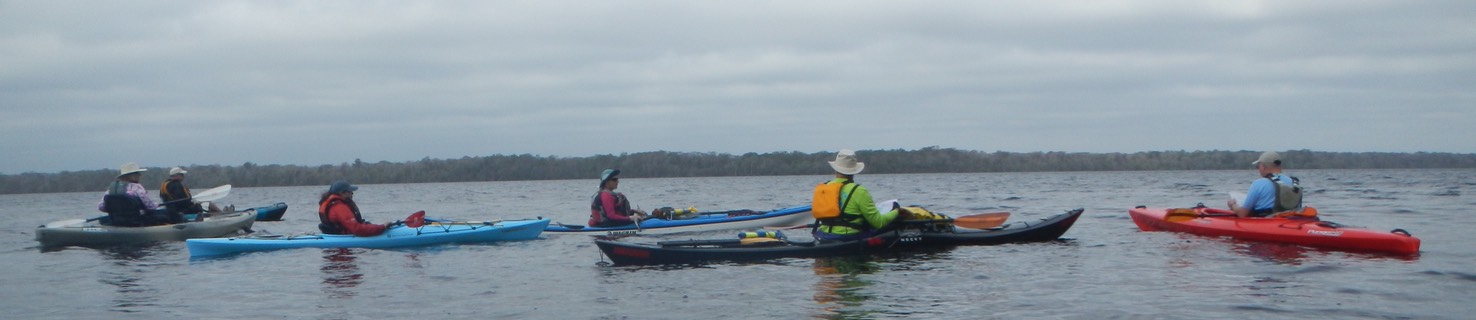
As we entered the lake we found the waves to be under a foot most of the time, and very close together. Our immediate goal was to reach Rocky Point (Bartram Site 27), some two miles upwind. We were making good time, even against the headwind and waves. At Rocky Point we rested in a lea cove. Doug Alderson, the Lead paddler, gathered the eight of us together and waited to see if there were others still out there heading our way. There were not. So we headed out into the wind once more. Our destination this time, Drayton Island.
It seemed that the wind had increased a bit as we left Rocky point for another two miles of banging into that growing headwind toward Drayton Island. At Drayton, we took shelter in another cove to rest, regroup and hydrate before pushing off on the last three miles to our campsite at Renegades on the River. We were now off the lake and in the St. Johns River. The river narrowed some but was still very wide, flowing northeast, right into the wind.
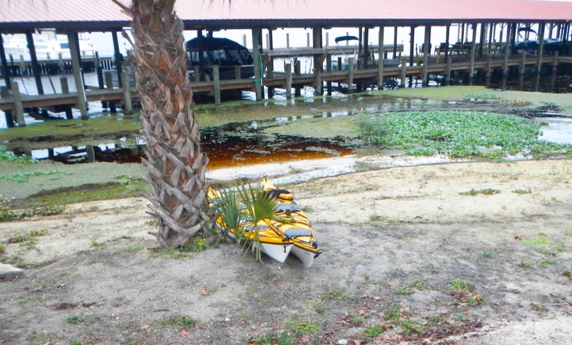
Finally, we rounded a point of land and could see Renegades in the distance. Once there, we couldn’t figure out how to get to shore, as it appeared to be completely blocked by docks. We eventually found a way to go around the end of one dock and under another to get to a take out. One member of our group struggled to get under the dock. There was just enough room to squeeze under if you played it right. I knew from experience that when you are trying to pass under an obstruction you must bend forward over the foredeck. If you can’t make it, you find out before you have the boat beyond the point of no return where you are laying back over the back deck and your chin is caught on an obstruction. I couldn’t convince this paddler that he needed to bend forward. I held my breath as he nearly capsized several times before he struggled through.
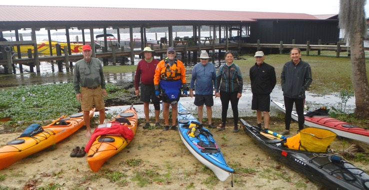
Seven of the eight Lake George Paddlers
So now we were at Renegades with no gear, no lunch and no idea where we were supposed to camp for the night. It would be a couple of hours before our gear and the other paddlers would arrive. It had started to rain, so we looked for shelter and thought about food. Alan and I walked over to the Tiki Bar thinking we might get something to eat there, but no luck. Renegades was a new establishment, unfinished and growing. We were told that the restaurant wasn’t yet open but that there was a temporary kitchen set up across the parking lot. So we headed across the parking lot toward a rig that looked like those used by street vendors. We decided on a burger and fries and were told it would be twenty minutes. Twenty minutes for a burger and fries?! Did we have a choice? That’s when I reached for my money and remembered that it was in my clothes bag, on the gear truck, probably still at Salt Springs. Thankfully, Alan covered the bill and we sat down out of the rain under an overhang, to wait for our food.
There were others under the overhang as well, two young families with little kids. I overheard them talking about their boats parked at the dock. I looked in the direction they were focused on and was shocked to see two forty-two foot cigarette type go-fast boats. Big go-fast boats like these cost a lot of money, hundreds of thousands of dollars, and these guys looked to be in their mid-thirties. The first guy asked, “ Do you have a Bimini top for your boat?” Second guy, “Yes”. First guy, “Can you travel at speed with that top up?”. Second Guy, “I never push it over 70 MPH with the top up, although the manufacturer says it’s safe to 90 MPH”. I don’t want to be out on the water with these guys. At 90 MPH they not only wouldn’t see me, the bump as they ran me over wouldn’t even register!
Finally, Alan got called and was handed one burger and fries. After he reminded the server that we had ordered two, the poor confused guy guessed he had given my burger to someone else. So Alan ate while I waited again, which was only right as he had paid the bill.
About that time the big Penske truck carrying our gear arrived and headed around a corner and out of sight. After wolfing down my burger, we followed the path the truck had taken to find our campsite. The grounds were marginal, much of it having been recently cleared. But Alan and I found places for our tents in a grassy patch and set up for the night. Dinner was our big surprise, a special treat, as the restaurant used our arrival to do a soft opening, testing out their kitchen and server routines. It was a great meal made better by our being inside out of the rain at real tables and chairs.

SUNDAY, DECEMBER 6, 2015 - ON THE BARTRAM HISTORY TRAIL:
Our Route Day 3: Renegades on the River (near 22), to Mount Royal Bartram site (21), Gates Ferry Landing, to Welaka Landing, to Welaka Spring Bartram site (17), to Satsuma Spring Bartram site (15, to Rodeheaver Boys Ranch ( at the bend above 14) Map from Putnam County Bertram Trail Brochure.

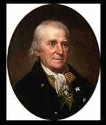
This day would be our heaviest Bartram History Trail day. We would visit several sites on our way to this night’s campsite at the Rodeheaver Boys Ranch. The morning dawned much as on the previous day; gray, overcast and windy, but with a hint of sunshine peaking through. Once on the water, our first Bertram site, Mount Royal, came up almost immediately (site 21 on the map). William Bartram visited this site twice, the first time with his father John and the last time by himself in 1774. The site is significant for its archeological value. It was a Timucua Indian burial site occupied from 1250 to 1500. Built up over the centuries, the mount as it is called, stands high above the river. William Bertram described his visit to this area in Part II, Chapter IV of his journal, Travels. Our two Bertram guides, Sam Carr and Dean Campbell, led us on this visit, with Sam doing a reading from Bartram’s book describing the place. Click here for more information about William Bertram and his travels in Florida.
At about fifty yards distance from the landing place, stands a magnificent Indian mount. About fifteen years ago I visited this place, at which time there were no settlements of white people, but all appeared wild and savage; yet in that uncultivated state it possessed an almost inexpressible air of grandeur, which was now entirely changed. At that time there was a very considerable extent of old fields round about the mount; there was also a large orange grove, together with palms and live oaks, extending from near the mount, along the banks, downwards, all of which has since been cleared away to make room for planting ground. But what greatly contributed towards completing the magnificence of the scene, was a noble Indian highway, which led from the great mount, on a straight line, three quarters of a mile, first through a point or wing of the orange grove, and continuing thence through an awful forest of live oaks, it was terminated by palms and laurel magnolias, on the verge of an oblong artificial lake, which was on the edge of an extensive green level savanna. This grand highway was about fifty yards wide, sunk a little below the common level, and the earth thrown up on each side, making a bank of about two feet high. Neither nature nor art could any where present a more striking contrast, as you approached this savanna. The glittering water pond played on the sight, through the dark grove, like a brilliant diamond, on the bosom of the illumined savanna, bordered with various flowery shrubs and plants; and as we advanced into the plain, the sight was agreeably relieved by a distant view of the forests, which partly environed the green expanse on the left hand, whilst the imagination was still flattered and entertained by the far distant misty points of the surrounding forests, which projected into the plain, alternately appearing and disappearing; making a grand sweep round on the right, to the distant banks of the great lake. But that venerable grove is now no more. All has been cleared away and planted with indigo, corn, and cotton, but since deserted: there was now scarcely five acres of ground under fence. It appeared like a desart [sic] to a great extent, and terminated, on the land side, by frightful thickets, and open pine forests. From Bertram’s Travels, Part II, Chapter IV
As Sam read and I looked down from the mount along the path of that long gone highway toward what had been a reflecting pool three quarters of a mile distant, the Royal Mount came to life in my mind. The scene had certainly changed since Bartram’s visits here some 241 years ago. And yet, all the elements were still there just as he described them. I was moved by the scene.
Conditions on the river were a bit better today, partly because there was less wind, partly because there were more twists and turns in this section of the river giving us some relief from the constant headwind, and partly because we began to see some sunshine for the first time.
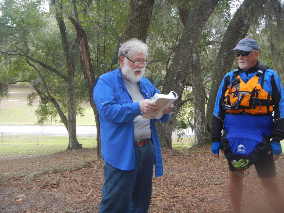
After Mount Royal we passed the Fort Gates Ferry Landing. This ferry, in operation for over a hundred years is the oldest on the St. Johns River and perhaps the oldest continuously operating ferry in the state. Soon after passing Gates Ferry we entered Little Lake George. It is smaller than big Lake George, but it is still a good size body of water. We hugged the East shoreline along the Welaka State Forest lands to stay out of the wind as much as we could.
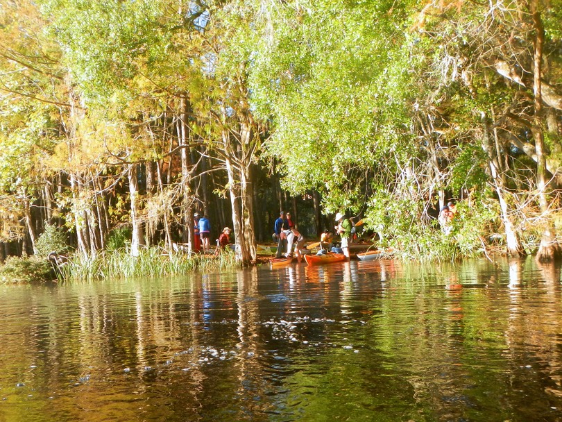
Re-entering the river again at Beecher Point, we soon reached Welaka Landing where we stopped for our lunch break. Paddle Florida lunches are not gourmet, but they provide the kinds of food you need to refuel, providing energy for the next leg of the trip. Following this day’s peanut butter and jelly sandwich and a Moon Pie, a sinful treat, Alan and I launched along with Doug Alderson and the lead paddlers, heading toward our next Bartram stop, Welaka Spring (17 on the map).
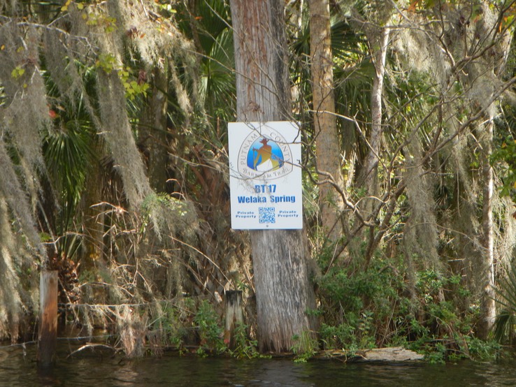
The short paddle up the creek and spring run to Welaka Spring felt like a different world when compared with the vastness of the river and lakes we had been paddling through. It was small and sheltered, and by closing my eyes to the civilization behind me, I could imagine that this was the Florida that Bertram experienced; a wild, untamed wilderness, ancient and primeval.
With our too brief sojourn to Welaka Spring over, we again turned our boats north, heading toward our next Bertram stop at Satsuma Springs (15 on the map). Satsuma Spring is on private land, but Sam Carr had gotten permission for us to stop there. A short walk from our landing under the arch of a massive live oak led us to the small spring. Sam again read from Bartram’s Travels, which described the spring so clearly that we could see that it hadn’t changed in any significant way since 1774.
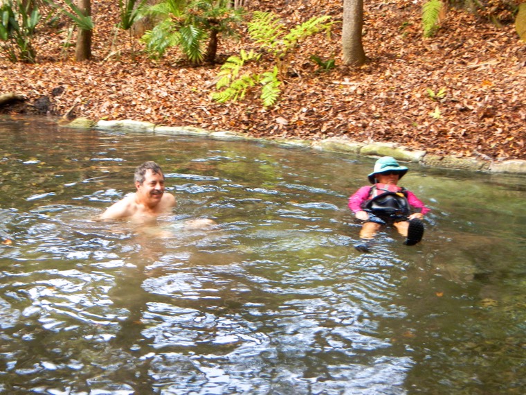
Several of our group decided to relax in the spring water, despite the fact that it had a noticeable sulfur smell. But then, I guess people used to pay to soak in sulfur springs thinking it was a cure for many ailments, so why not? After time spent at the spring listening to Sam, talking among ourselves and playing with the owners two beautiful Standard Poodles we headed back to the boats to complete our trip to Rodeheaver Boys Ranch (at the bend just above 14-Saratoga Harbor on the map.
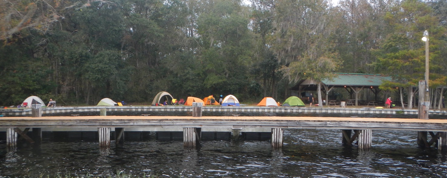
Camping at Rodeheaver Boys Ranch
I didn’t know what to expect from a place called a “boys ranch”. As it turns out, the ranch houses boys in foster care who for one reason or another do not fit with families at this time in their lives. I have an adopted son who spent some time in a facility like this one. He found it to be a positive experience. However, we were located at the waterfront, isolated and far removed from the boy’s residences. The grounds were clean, dry and well maintained. Every tent had a water view and there was a covered pavilion for meals and entertainment. Eventually we were taken further in to the ranch property for showers. On the way we saw residences, educational buildings and boys of all ages playing flag football.
December 7, Pearl Harbor Day, “A day that will live in infamy.” But for us it was a great day, perhaps the best day of the trip.
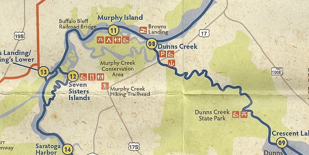
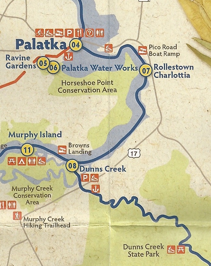
Our route: From the bend above Saratoga Harbor, through the Seven Sisters Islands, and into a series of creeks (Trout Creek, Murphy Creek, Dunns Creek) stopping for lunch at Georgia Boys Fish Camp (near 8 on the map), then on to our destination at Dunns Creek State Park. Over 16 miles in all.
This was a great day. We had mostly sunny skies, light winds and much narrower bodies of water to paddle. Narrower in this sense is relative, as these creeks were wider than some “rivers” I’ve paddled. Never-the-less, they provided some much needed relief from the wide open waters paddled thus far. And they were more interesting as both shores were accessible providing views of both natural and human “wildlife”.
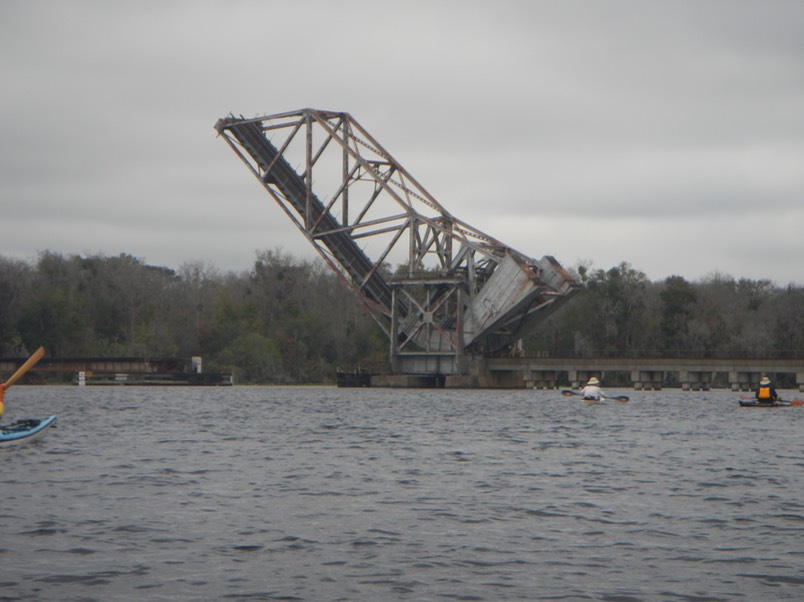
For example, there was the railroad lift bridge that seemed to be stationed in a permanent salute.
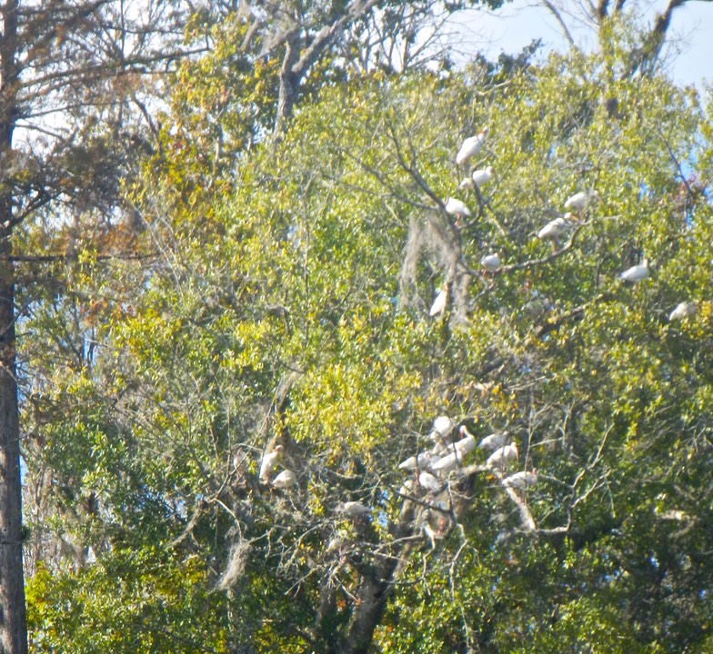
And this Cloud of Ibis sunning in a Live Oak tree.
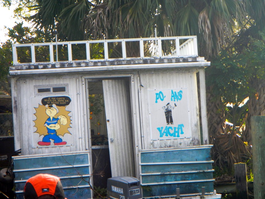
And this “Po Ass Yacht”!
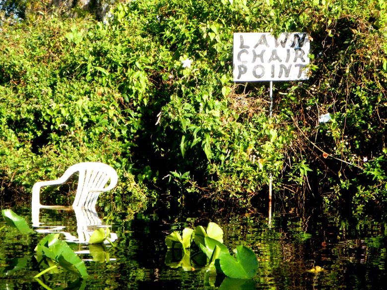
And Lawn Chair Point: Looks like a cool and comfortable place to kick back and relax!
These and other sights greeted us until we passed the upturned bridge and rounded into Dunn’s Creek and Georgia Boy’s Fish Camp (08 on the map above). Georgia Boy’s Fish Camp is said to be the oldest continuously operating fish camp in the state. To be honest, it looked like it might have been. What wasn’t old was underwater, though a few rental cabins had new roofs and looked habitable. The Fish Camp is for sale by the way, if you’re looking for a retirement business.
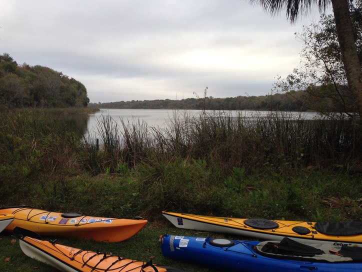
From Georgia Boy’s it was only about five miles to Dunn’s Creek State Park, our camping destination for the evening. This state park is “under development”, which means that many of the amenities we expect in Florida State Parks are not present yet. We had port-potties instead of flush toilets for example, no pavilions for shelter and no picnic tables that I remember. Yet this was a lovely park offering more wilderness than most, with quickly made nature trails and a crude but very adequate place to take-out and launch our boats. In some ways I would hate to see too much development of this park. It was really lovely as we found it.
TUESDAY, DECEMBER 8, 2015 - BACK TO PALATKA:
Our return to Palate took us back down Dunn’s Creek, with another stop at Georgia Boys Fish Camp for an early lunch. Then back onto the St. Johns River. The day once again held mixed sun and clouds and that strong head wind as we paddled northeast toward Palatka. Different groups of paddlers tried different strategies to reduce the effects of the wind. But in the end, there was little relief. Alan, Ray and I paddled together. We could not see our destination until we rounded the point above the Pico Road Boat Ramp. Then it was a clear but long shot across the river to our takeout at the place where we started five days earlier.
COMMENTS:
